A trekking route for the most passionate, with dirt roads in the countryside, picturesque villages, forests, vineyards and abbeys.
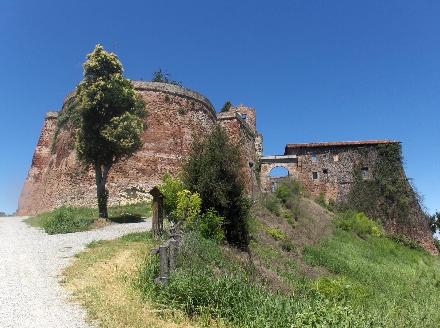
The route comes down from Tuffo and reach the Valley of Praia, then it's going up leaving the hamlet of Buggiali on the left and come down again until Radicati square. From here the route follows the road for Grisoglio along a paved municipal road and, after about 500 meters, it's reached the center of Brozolo where the seventeenth-century church of San Giorgio is. The route continues on the municipal road and, crossing the village of Piai with the eighteenth century Church of S. Stefano, a century-old oak is the indication to turn left and start the journey on dirt roads. After a short ascent and descent, the route turn left again and, after a short stretch of dirt road, there are beautiful views of the hills of Casale Monferrato. At about 3.5 km from Brozolo, you have to keep left at the next two forks until you descend to the stream. The route crosses it through a ford and it immediately goes up a country road almost in front of the crossing point. At the top it continues to the right for a dirt track with a natural background. Then it climbs up to the left, leaving the Cervoto Fraction on the right. At the end of this country road, it takes a stretch of asphalt road and head to the left until the Longagnano village (km 7.80 from Brozolo). From this locality the route is first a natural track and after about 9 km from Brozolo it turn right into a wooded path that allows you to glimpse the village of Verrua Savoia. The route continues to the left in the direction of Monte and, leaving the forest, past a vineyard you reach the hamlet. Now the route goes down on the asphalt road and at km 10.5 (from Brozolo) it turns left for a short distance. After about 500 m it turn to the right instead, towards the church of S. Rocco in the hamlet of Camorano. After the church begins another stretch in the woods to the bottom of the valley where you have to turn left to go up after about 300 m to the right for a dirt road. After about 500 m it turns to the right instead, towards the church of S. Rocco in the hamlet of Camorano. After the church begins another stretch in the woods to the bottom of the valley where you have to turn left to go up after about 300 m to the right for a dirt road. At the end of the climb you'll start to see the Sabauda fortress and, to the right, the Po plain. The route descend again to the hamlet of Cascine where it takes the asphalted municipal road to go up to a curve where the fortress of Verrua appears. Then it takes the last stretch of dirt road that allows you to reach the final destination.
Riepilogo
10020 Verrua Savoia TO
Italy
Strada del Pilone 14
14023 Cocconato AT
Italy